Result: Success!!
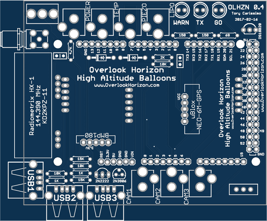
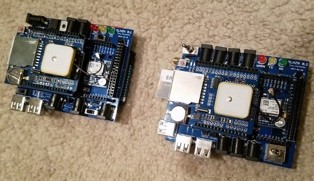
OLHZN-5 was the fifth high altitude weather balloon flight for Overlook Horizon High Altitude Balloons. This flight launched on March 26, 2017 at exactly 12:25:27pm EDT (16:25:27 UTC) and featured some tech changes to our tracking apparatus to resolve our radio tracking issues that we experienced on OLHZN-3 and OLHZN-4. This flight debuted our newly designed custom circuit boards for better reliability and to eliminate possible problems on launch day.
The day started off well. The setup of our new broadcasting equipment and tracking systems took about 15 minutes longer than expected so we started a little behind schedule, but it wasn’t too bad. The countdown and broadcast which should’ve started at 11:00am EDT, was 15 minutes later than planned. All continued to go well until the wind started to pick up which made filling and controlling the balloon very difficult. This caused about another 10 minutes in additional delays which led to a launch that was overall about 25 minutes later than expected.
Once launched, the flight radio transmission systems began and continued transmitting perfectly, as planned, throughout the entire flight which makes this flight’s primary objective a 100% success! There were a few slight issues that occurred during the flight, though. First, one of the cameras was powered on, but failed to begin recording. This was a slight issue with our launch checklist that we’ll correct for the next launch. More significant though is that the balloon ended up being under inflated slightly which led to a flight time that was longer than planned. It also resulted in the payload drifting a little further to the east than we expected and planned for. The good news, however, is that with the radio transmitter working perfectly, we were able to monitor the entire flight path and we were waiting at the landing site at the very moment that the flight descended and landed behind some trees.
At 1:34pm EDT, just under 70 minutes into our flight, we inadvertently experienced a close flyby / flyover from an Airbus A319 operated by Delta Air Lines. The flight (DAL159) #159 was en-route from Boston, MA to Detroit, MI when it passed above our payload at 38,000 FT. in close proximity. A video of this event can be seen here. With the added attention we received from this flyby video, we feel it’s important to point out that we do follow all FAA Regulations regarding unmanned free balloon flights. You can read more about our safety procedures and regulations we follow on our flight safety & regulations page here.
The most unfortunate and stressful part of the flight came when we went to retrieve the payload from behind that tree line and discovered that the payload was still about 20 feet off the ground and that the very end of the payload train, right next to the balloon, just barely snagged a 230kV high voltage power transmission line controlled by National Grid USA and connected directly to the substation at Nine Mile Point Nuclear Station! We immediately contacted National Grid to assist in releasing the payload. After waiting for 4 hours for help, we decided to retire for the night and go back home, however, as luck would have it, when we returned home, we got a call from National Grid that they would be on site around 2:00am EDT and that we needed to meet them there for retrieval. We arrived on site and watched them quickly remove the payload from the lines and were able to recover our materials.
When the payload landed, all electronic operation ceased abruptly. We feared that a major power surged destroyed everything! Fortunately, all our data survived and most of our electronic equipment survived. Unfortunately, our cameras were partially damaged by the power lines so new cameras will likely be needed for future flights, but the photos and videos contained on the SD cards as well as the telemetry and sensor data on the SD cards were all retrievable. The final landing video was originally in a corrupt state due to the abrupt stop to the recording, but we were able to repair this video to finally see what the landing looked like. We noticed a few power cycles occurring during the final 5 minutes of the flight. We suspect it may be a loose connection, but we’ll be doing some testing on that for the next flight. Overall, this high altitude balloon flight was a very big success, with an extremely inconvenient ending!
Design Modifications
The following design modifications were made on our new custom circuit boards:
- Voltage divider resistor values increased by 100x to reduce current draw on voltage measurements
- Now using rechargeable 3.7v 18650 Lithium-Ion batteries for both main and camera power.
- 3rd camera circuit added for a upward (balloon) facing burst camera. This will not be used on OLHZN-5, but will likely make its debut on OLHZN-6.
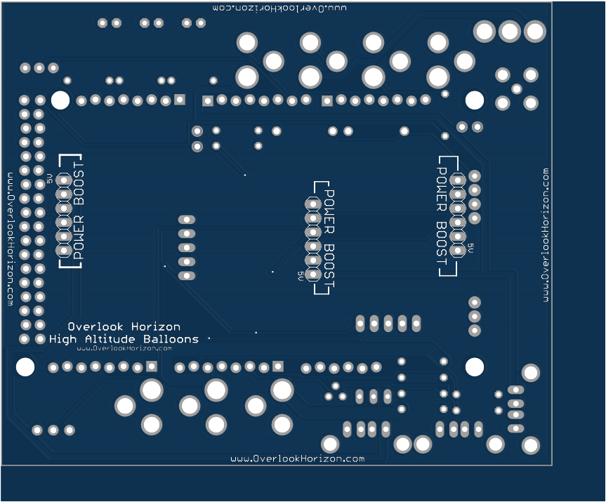
- 3 Adafruit Powerboosters added to reduce battery weight by converting a single 3.7v battery to 5v for cameras this also allows us to switch on/off the cameras with a low amperage (500mA) switch instead of requiring a more robust 6A switch.
- Internal temperature sensor changed from a weatherproof wired component to an onboard DS18B20 to eliminate the extra internal wire.
- Added master switch for main power (SPDT) to make it easier to prepare for launch.
- Moved power outage alarm off the raw 5V feed to a digital output feed so that the alarm can be triggered for other instances in addition to power outages.
- External components (camera power, power outage alarm, landing alarm, outside temperature) are now connected via 2.5mm DC barrel plugs for easy connectivity and launch day assembly.

Flight Videos
Flight Data
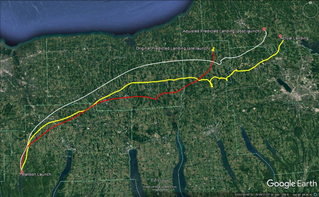
Flight Prediction Comparisons
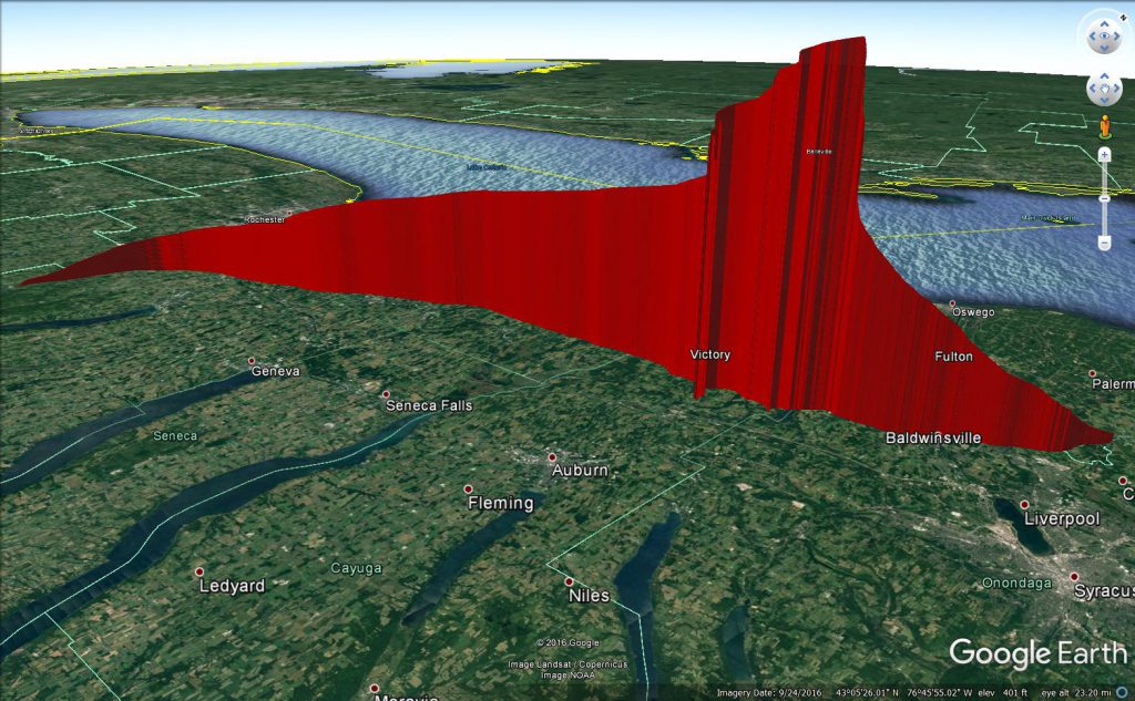
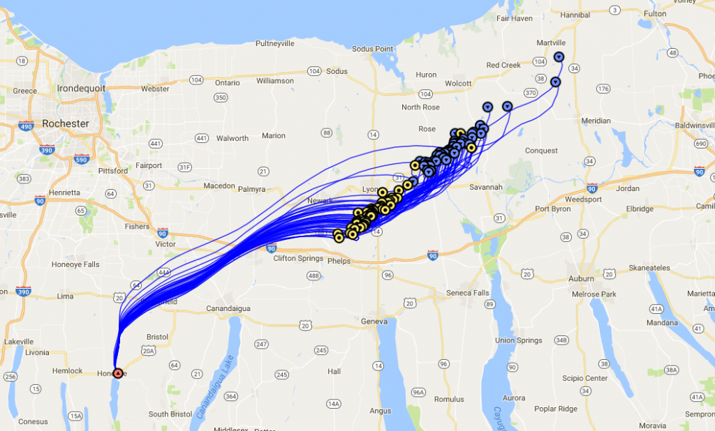
Actual 3D Flight Path
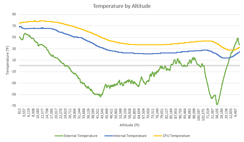
Temperature by Altitude
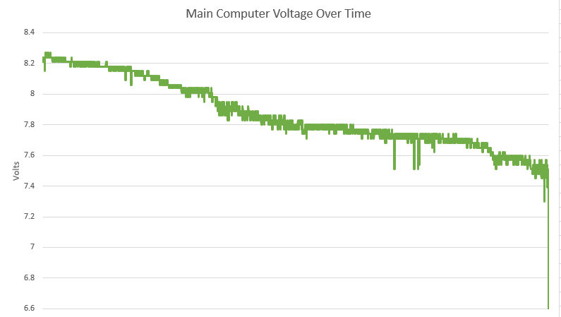
Main Battery Voltage
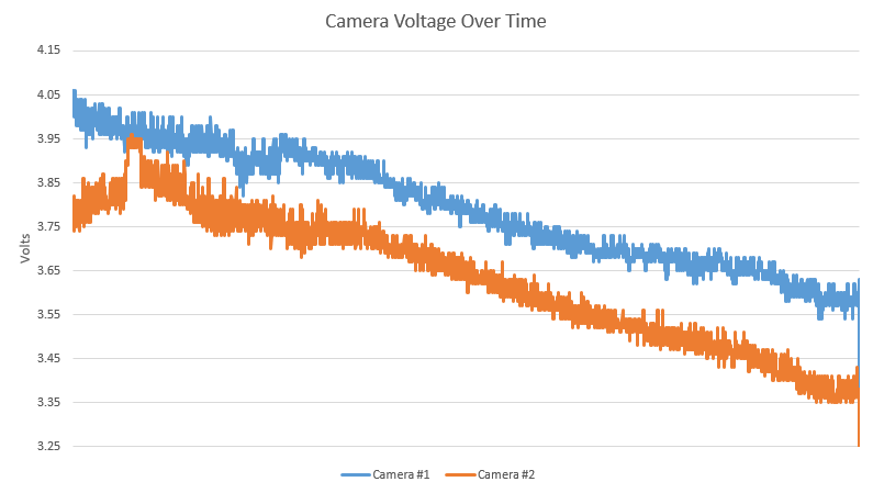
Camera Battery Voltages
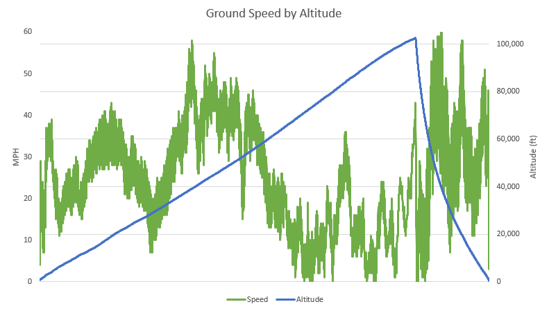
Ground Speed by Altitude
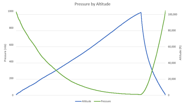
Pressure by Altitude
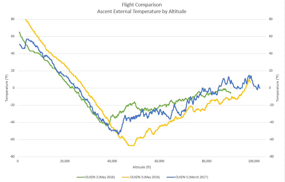
Flight Comparison
Ascent Temperature by Altitude
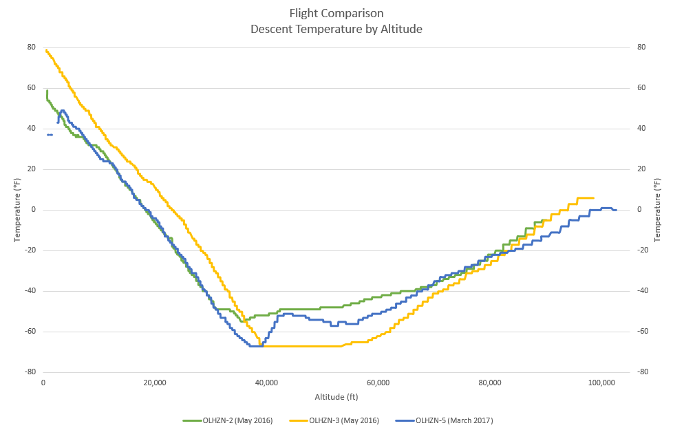
Flight Comparison
Descent Temperature by Altitude
Original Flight Predictions
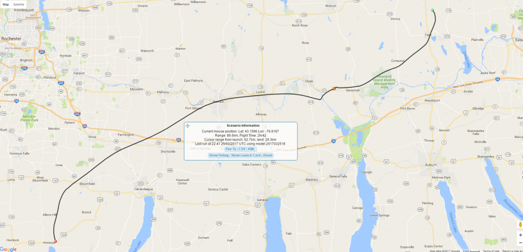
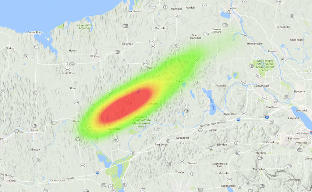
Final Flight Predictions
This maps represent our original pre-launch predictions. We generate predictions 3 times daily during the week leading up to launch day. These final predictions are the last predictions run just 4 hours prior to launch time. Unfortunately, these predictions turned out to be slightly inaccurate due to the balloon being under-inflated during the filling process. The launch time was quite windy and created aerodynamic lift on the balloon which deceived us into thinking the balloon was filled to the proper capacity as it lifted our calibrated counterweight. Once the balloon was launched, we were able to quickly determine that the balloon was under-inflated based on its ascent rate. An under inflated balloon results in the balloon remaining in the jet stream for a longer period of time. This means the balloon generally travels farther (usually east), the flight lasts longer (an extra 49 minutes in this case) and the balloon travels higher (102,544 FT in this case).
New Custom Circuit Boards
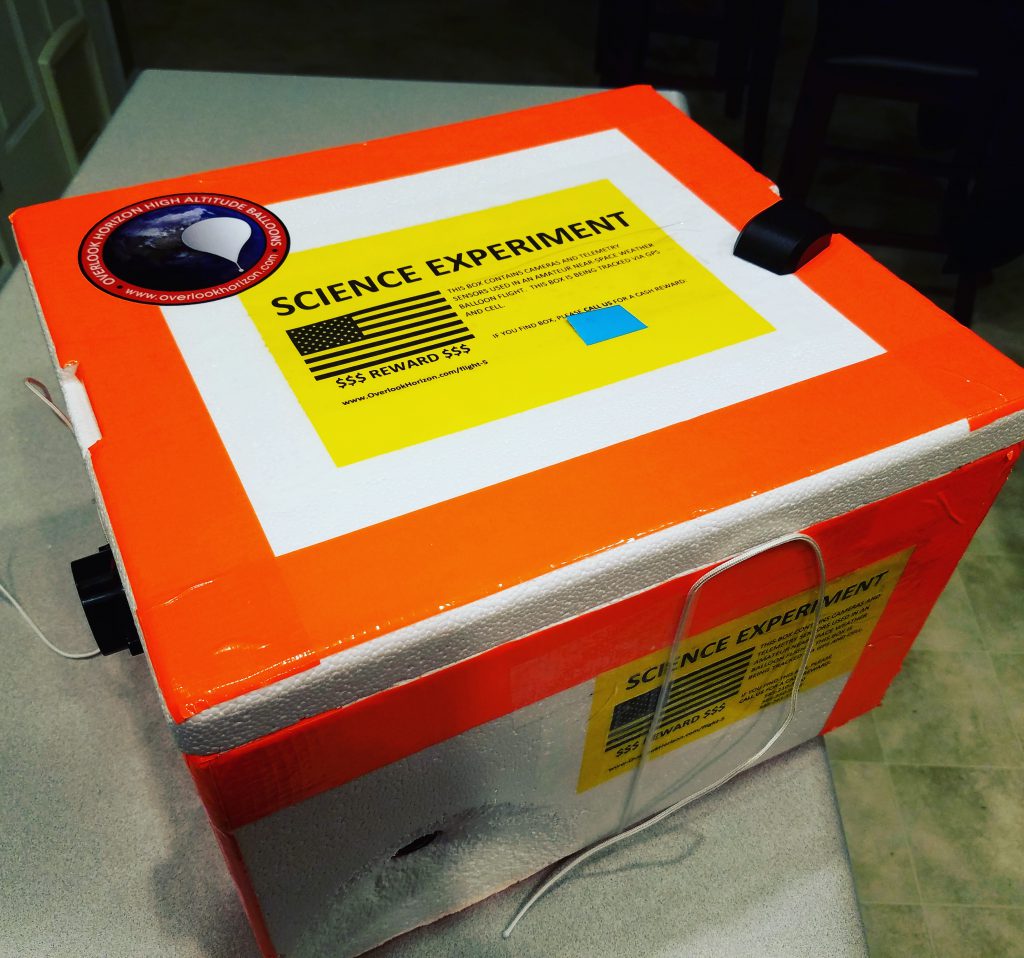
Payload