OLHZN-1 was the first high altitude weather balloon flight attempt for Overlook Horizon High Altitude Balloons that took place on Saturday, April 23, 2016. The goal of the first flight was to get comfortable with the launch and recovery methods and to test all our systems. Sadly, the payload itself was lost and not recovered. The launch itself had a great start. We were a little off on the amount of time needed to prepare the launch and ended up launching at 8:58:37am EDT (12:58:37 UTC) which is just about an hour later than we hoped to launch. That’s not a huge issue, but probably slightly annoying for our live stream viewers that had to wait an extra hour for launch. We eventually got all systems attached, powered and ready to go. It was very cold (about 38° F / 3° C) and a little on the windy side during launch prep. Likely, we’ll try to avoid that in the future. The cold conditions led to us rushing a bit to get it launched and the windy conditions made it difficult to verify that the balloon was filled to the proper volume. Upon liftoff, the balloon operations were fantastic. The radio tracking signals were much stronger than we expected and we were receiving perfectly clear signals despite the large distance between us and the balloon. Unfortunately, we received the last signal 27 minutes into the flight and then all transmissions ceased. At this time, we suspect that the power on the Arduino was drained faster than we expected and the Arduino lost power and all capability to transmit its position. We had a backup GPS locator on board that would use a 3G/4G cellular signal to report its location upon landing. The device was quite old and we were unsure how the battery life would perform. Additionally, we couldn’t be certain that it would land somewhere with cellular reception. Ultimately, this tracker never reported its position and completely failed due to either battery or lack of reception at the landing site. Unfortunately, the payload still remains undiscovered, but we obtained some great information from the flight while it was transmitting and we also learned much during the launch to refine those procedures for efficiency next time around. Check out Launch #2 for our return to flight and first successful payload recovery.
Flight Path
Our actual flight path that was recorded prior to losing contact with the payload.
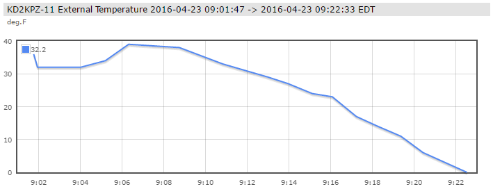
External Temperatures
Actual recorded temperatures outside of the payload package prior to loss of signal.
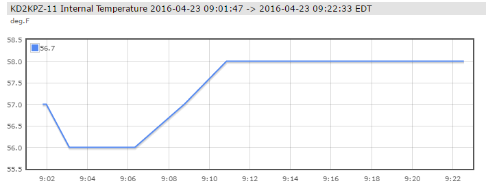
Internal Temperature
Temperatures recorded inside the payload package prior to losing contact with the payload.
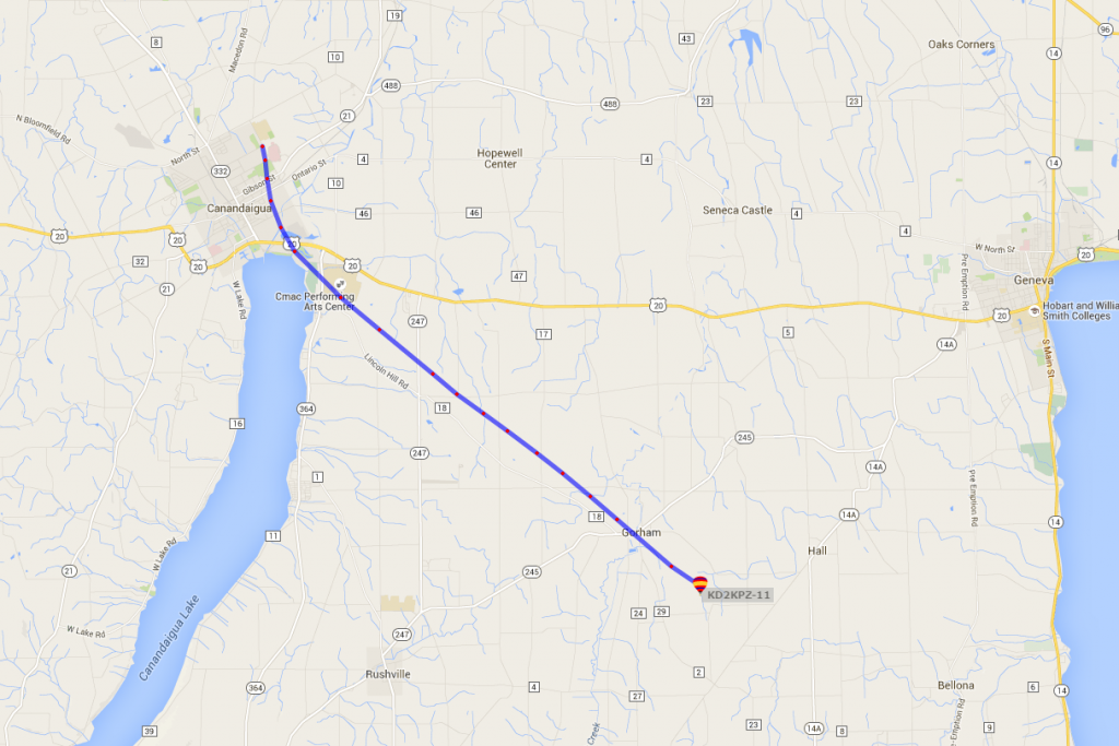
Flight Map
The actual recorded flight path prior to loss of signal.
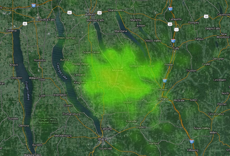
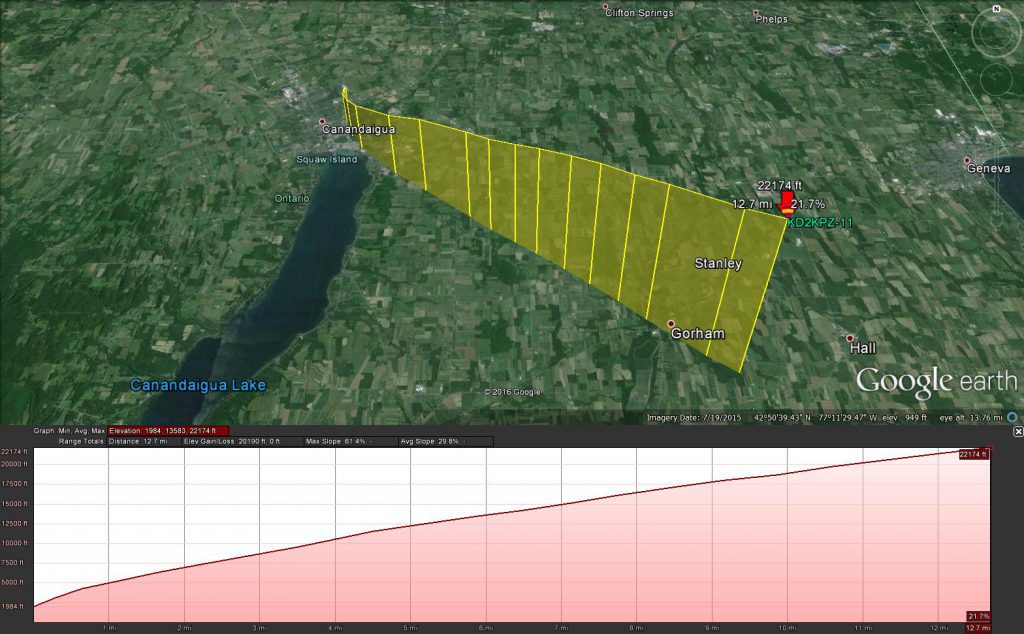
Landing Estimates
Based on the data we were able to record, the image above represents the rough location of where we expect that the payload landed.
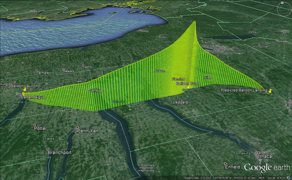
Predicted Flight Plan
The prediction above was the intended flight plan we expected prior to launch day.
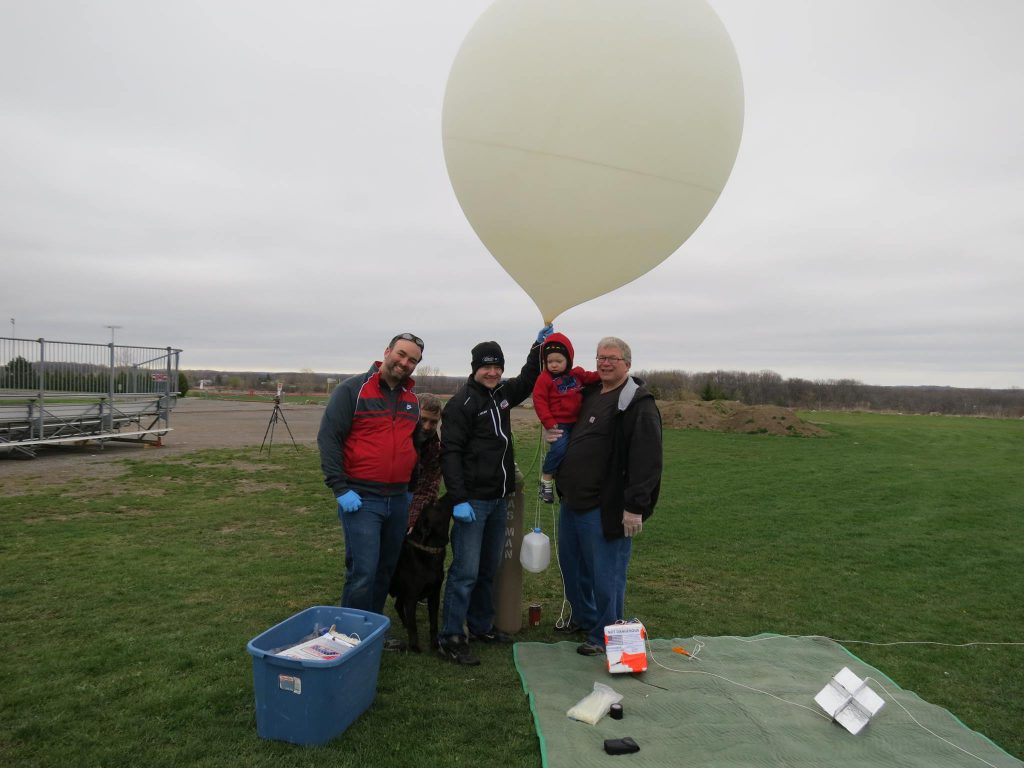
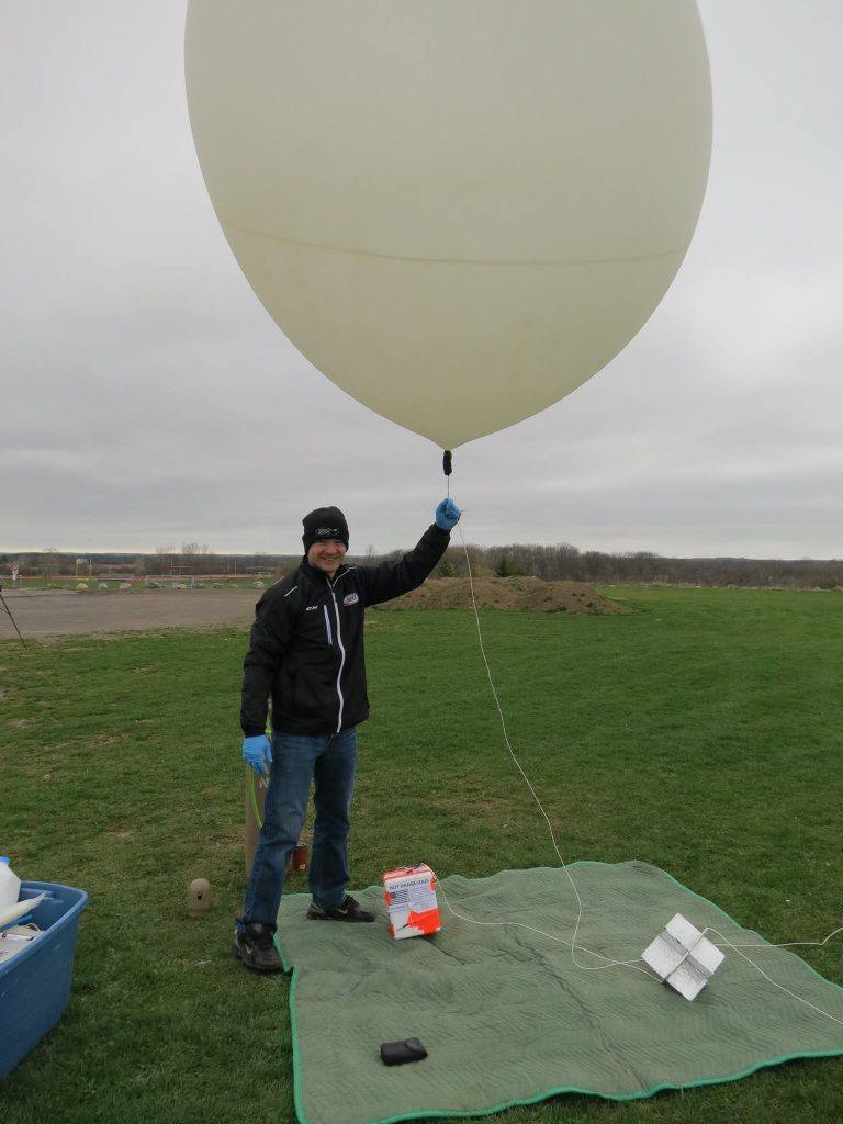
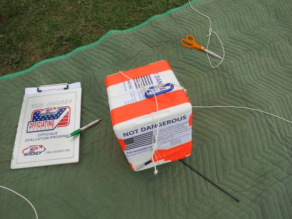
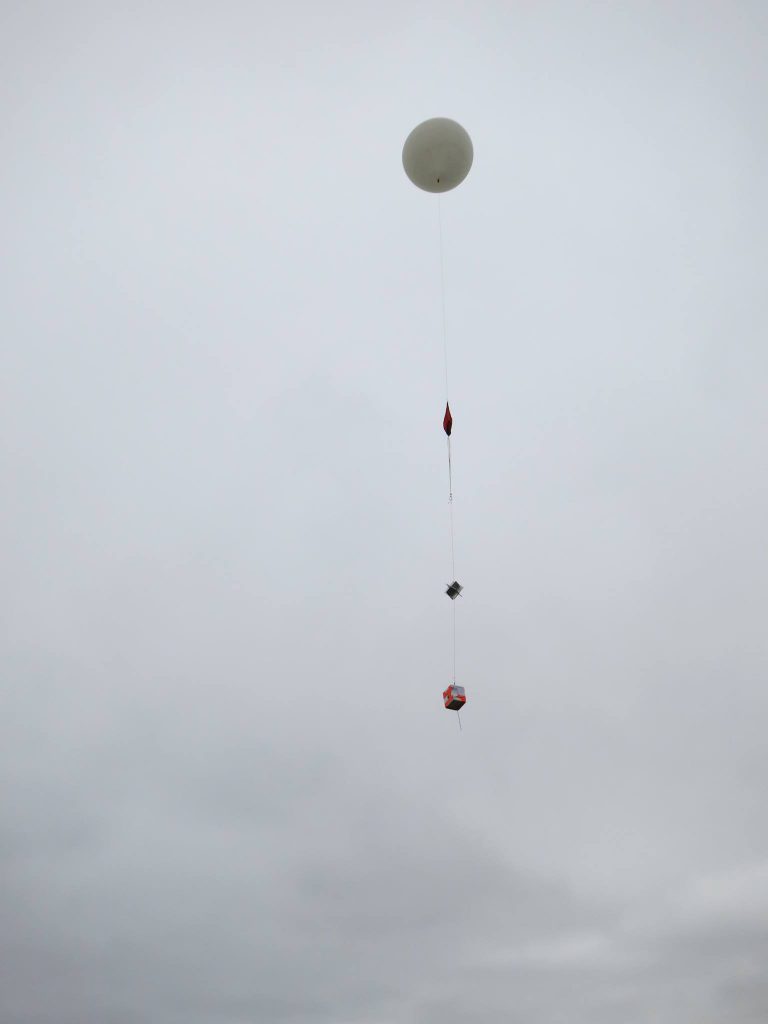
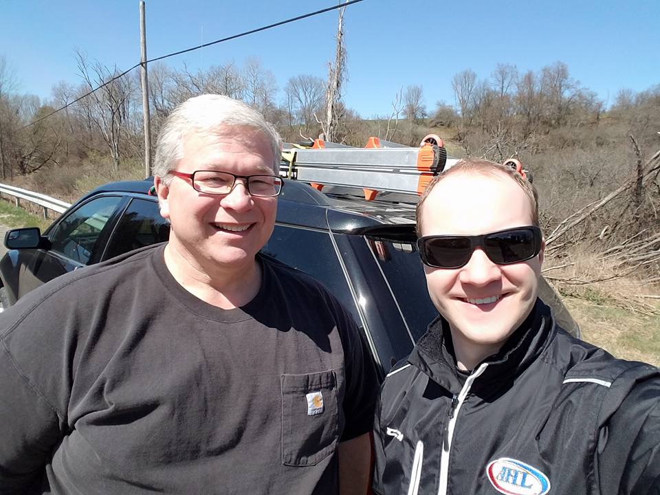
Launch Day Photos
Technical Specifications